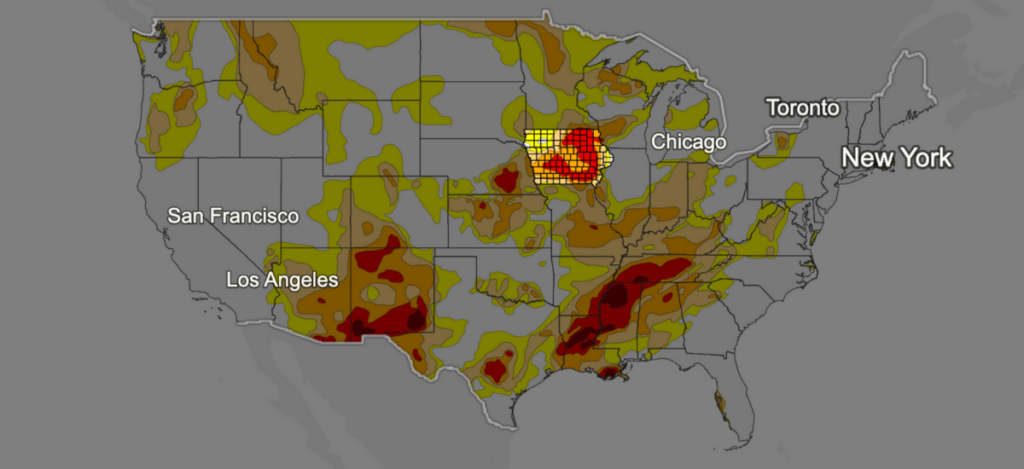
Iowa Drought Map This map provides an accurate depiction of location and severity of drought. Depending on intensity, drought maps can be used as triggers for disaster declarations and loan eligibility with the United States Department of Agriculture. Read More